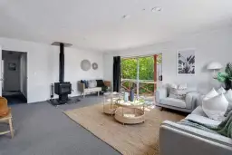
417 Wakefield Quay, Stepneyville, Nelson
4
190m2
502m2
Council Data
Last update : Invalid Date Invalid Date Invalid Date
Improvement value
Land value
CV(Year Invalid Date Month Invalid Date)
Deck
View type
Contour
Land area
Floor area
Decade of construction
Title
Type of title
Legal description
Council
Estate description
Construction
Condition
School zones
Property history
Please login
For developers
Unitary plan:-
Land:502m²
Title:Freehold