


All offers are invited by 2pm, Thursday 30 May 2024 (will not be sold prior).
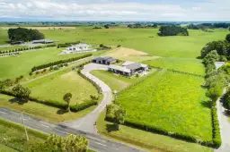
Misty Hills is a first rotation Pinus Radiata forest, located on Ongo Road, in the Rangitikei Region, approximately 45 kilometres inland from Turakina/Whanganui and eight kilometres from Hunterville.
Currently comprising 698.6282 hectares (more or less) with a total forested area of approximately 563 hectares. Made up of: 525.5 hectares of 2019 and 2020 plantings currently registered in the Emissions Trading Scheme under the averaging scheme, with a further 28ha (approximately) of 2022 plantings yet to be registered, while the balance is ten hectares of pre-1990 Pine Forest. The Vendor will retain all accumulated Carbon Credits up to settlement/transfer date.
Consisting of eight titles, there is one title currently under survey to remove an older house and surrounding unplanted paddocks, with an estimated area of six hectares.
There is currently a cutting right registered across all of the 2019-2024 plantings with a ‘buy-out’ process in place, due diligence is required. This right is registered for a period of 35 years from the year of establishment. All post-2019 plantings have been professionally managed from the outset.
Situated at between 100m and 300m above sea level, Misty Hills is well-tracked and in a renowned location for excellent commercial forestry in New Zealand.
For more comprehensive information contact the listing agents, viewings will be by private appointment to all qualified buyers.
NB. Boundary Lines are indicative only
Name | Distance | 类型 | Year | 属性 | Gender | Score | Decile | |
|---|---|---|---|---|---|---|---|---|
Hunterville Consolidated School | 6.13 km | Primary | 1-8 | Government | Co-Educational | EQI: 459 | 5 |
Address | Distance | Bed | Bath | Floor area | Sold date | Sold | Data source | |
|---|---|---|---|---|---|---|---|---|
 | 0.27 km | 4 | 2 | 300m2 | 2024年04月12日 | $560,000 | Council approved | |
 | 0.77 km | 3 | 1 | 150m2 | 2024年04月02日 | $500,000 | Council approved | |
 | 0.74 km | 3 | 1 | 80m2 | 2024年03月15日 | $420,000 | Council approved | |
 | 0.77 km | 5 | 1 | 220m2 | 2024年01月16日 | $648,000 | Council approved | |
 | 5.19 km | 4 | 2 | 235m2 | 2023年12月23日 | $1,400,000 | Council approved |