
Play


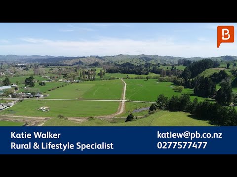
This super contoured dairy farm on the outskirts of Taumarunui is an outstanding opportunity. The property is 100.37 ha (STS) (approx) plus 2 lease blocks that make up the 125 ha (approx) milking platform producing an average of 90,000 kgMS from 300 cows. Located just 8.5 km from Taumarunui township, on the edge of the Whanganui River, the dairy platform has an excellent layout with short walks on flat to easy rolling contour. The cow shed is centrally located and is supported by a good range of farm buildings. The main home is a comfortable four bedroom home plus there are 2 one bedroom studio unit dwellings for staff. Dairy farms are not offered in this area very often and this is one of the best located and contoured in the district. This compact operation could be an exceptional option for first time farm owners moving on from sharemilking, or it could be added to an existing farming operation or as a potential development project for the future.
Address | Distance | Bed | Bath | Floor area | Sold date | Sold | Data source | |
|---|---|---|---|---|---|---|---|---|
 | 24.48 km | -m2 | Year 2024 Month 04 Day 18 | $32,500 | Council approved | |||
 | 3.21 km | 2 | 1 | 82m2 | Year 2024 Month 04 Day 03 | $310,000 | Council approved | |
 | 16.61 km | 3 | 1 | 100m2 | Year 2024 Month 03 Day 04 | $339,000 | Council approved | |
 | 2.21 km | 3 | 1 | 110m2 | Year 2024 Month 02 Day 15 | $496,000 | Council approved | |
 | 17.05 km | 3 | 1 | 90m2 | Year 2024 Month 01 Day 16 | $280,000 | Council approved |