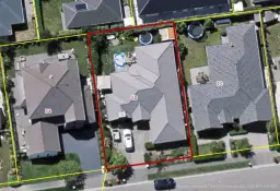
43 Rotoiti Lane, Northwood, Christchurch
4
143m2
Council Data
Last update : 2024 06 25
Improvement value$270,000Increased by 10% from year 2019
Land value$400,000Increased by 86% from year 2019
CV(Year 2022 Month 08)$670,000Increased by 45% from year 2019
View type
Contour
Floor area
Decade of construction
Title
Type of title
Legal description
Council
Estate description
Construction
Condition
Zoning
School zones
Property history
Please login
For developers
Unitary plan:Specific Purpose (Golf Resort)
Land:-
Title:Leasehold